Maps Page on
Thailand
Outline
- Physical Environment
- Physical Boundary Map
- Relief Map
- Physiographical Map
- Weather & Climate
- Temperature Map
- Rainfall Map
- UV Index Map
- Human Environment
- Population Density Map
- Land use & Zoning
Map
- Economic Activity Map
- Road maps
- Administrative Road Map
- Basic Transportation Infrastructure
Map
- Detailed Transportation
Infrastructure Map
- City Maps
- Map of Metropolitan
Bangkok
- Map of Chiang Mai
- Map of Udon Thani
- Urban Transportation Maps
- Map of Bus Routes in
Bangkok
- Bangkok Subway Line Map
- Map of Bus Routes in
Chiang Mai
- Tourist Maps
- Map of Tourist Attractions
in Chiang Mai
- Map of Tourist
Attractions in Bangkok
- Map of Ko Samui
Descriptions
will precede each map and maps are linked directly to their source.
1 Physical
Environment
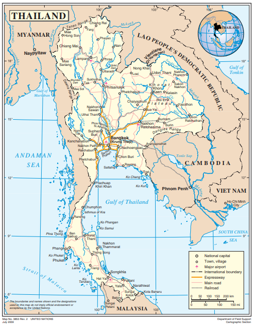
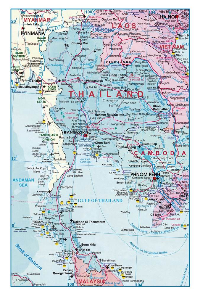
This map shows
the physical boundaries of Thailand and the surrounding nations. It does also
include transportation information.
A relief map
shows the terrain of Thailand and surrounding nations.
This is a map
of the physiography of Thailand including national parks, historical sites, and
elevation points.

2 Weather &
Climate
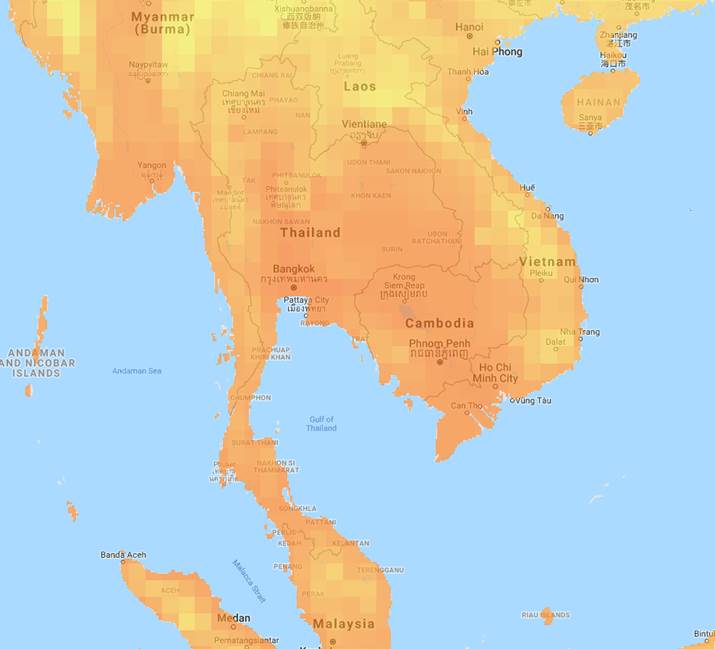
The average temperature based on data from 1991-2015 is depicted in this map. The average temperature ranges between 20-40* Celsius (68-104* Fahrenheit) based on the shading of the colors. The southern and south eastern areas of Thailand are the warmest with the more mountainous regions to the north are cooler.
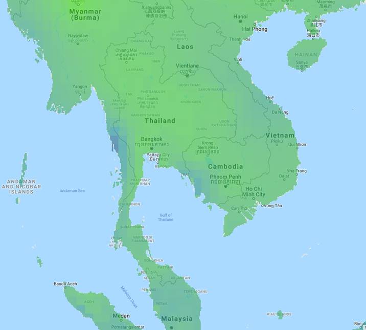
This is a map showing the average rainfall in Thailand based on data collected from 1991-2015. The average rainfall ranges from 500 – 5,000 mm (19.68 to 196.85 inches [16.4 feet]) per year depending on the region.
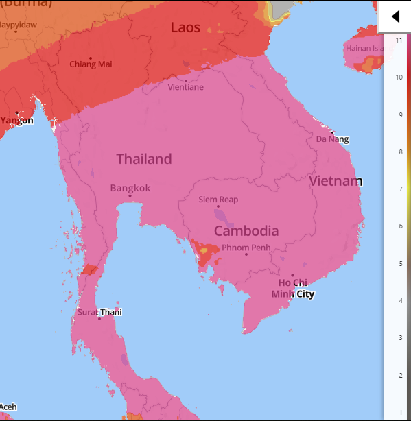
This map shows the UV index for Thailand on 3/2/2019. The country has a high UV Index which means unprotected skin will be definitely be harmed in a short period of time if exposed outside.
3 Human Environment
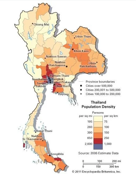
Population density in Thailand is shown in this map. The most populace regions surround Bangkok.
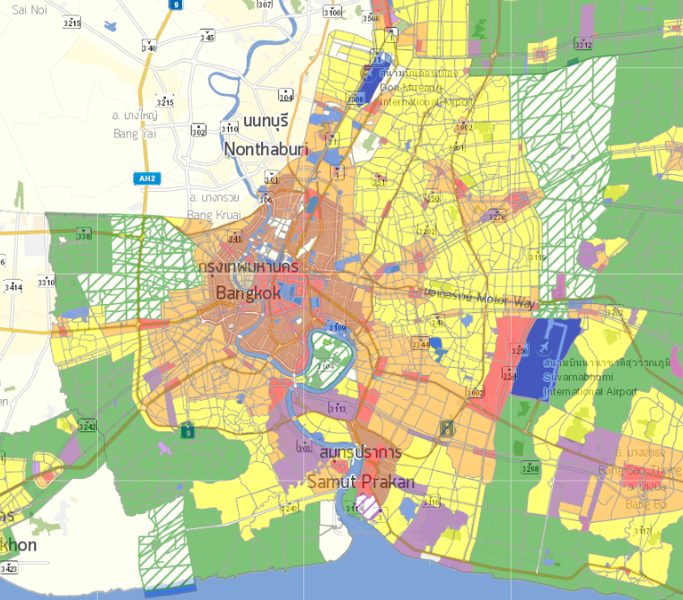
This is a map showing the land use zoning in Bangkok. After searching for Bangkok’s zoning color code, I found the designations in their Warm Welcome to City Planning Department – Bangkok Metropolitan Administration document. Red is commercial, blue is government institutes/public utilities/ off-white amenities, is Thai art and culture conservation, brown is high-density residential, orange is medium-density residential, yellow is low-density residential, purple is industrial, green striped is rural and agricultural conservation, and solid green is rural and agricultural. This depicts that the center of the city is general where business and commerce is prevalent, housing is generally compact and close together, and population density tends to disperse the farther one gets from the city center.
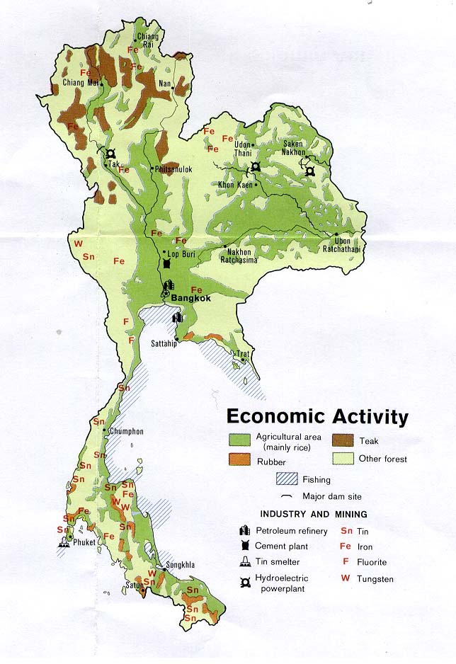
This is a map depicting the economic activity of Thailand as of 1974.
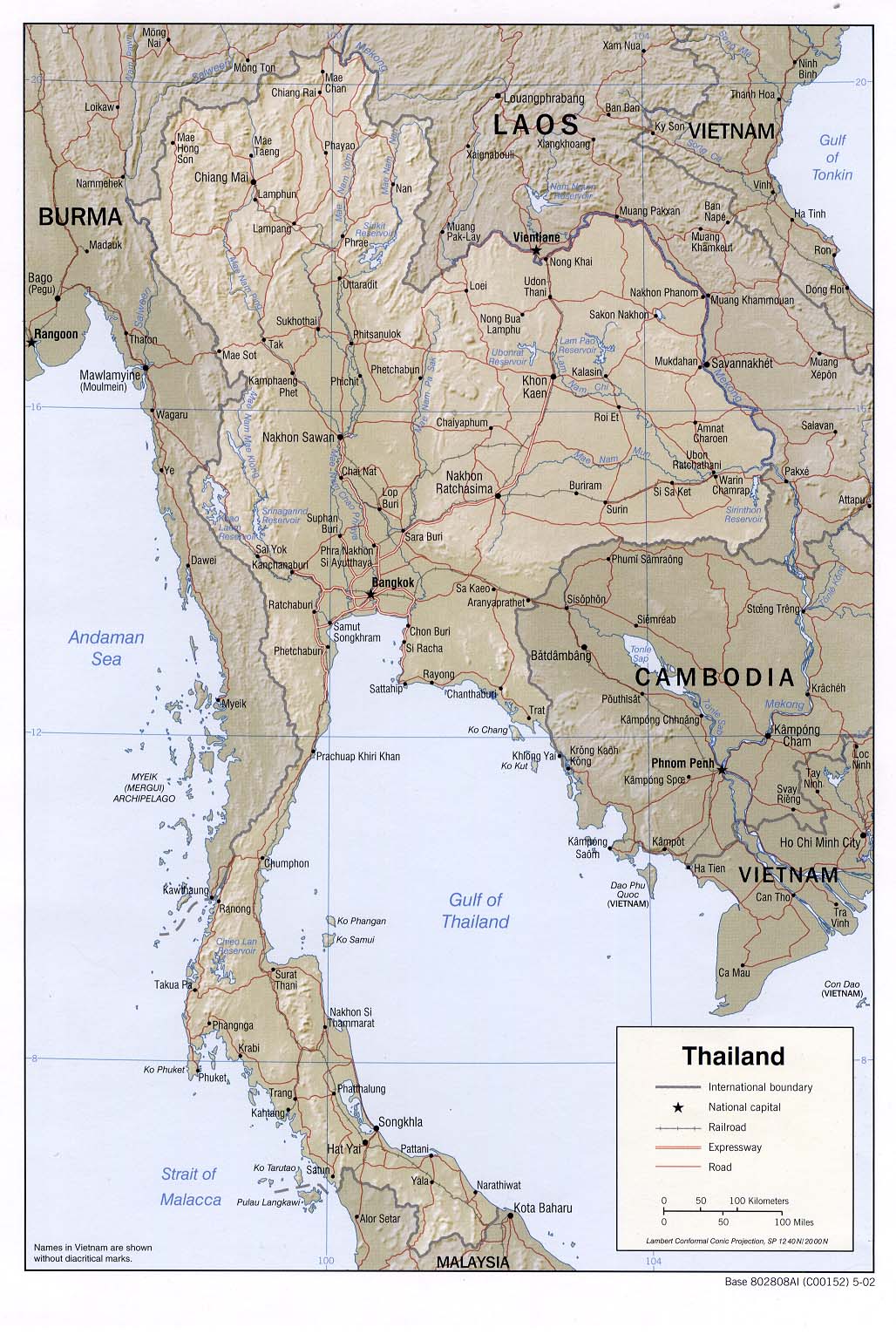
4 Road Maps
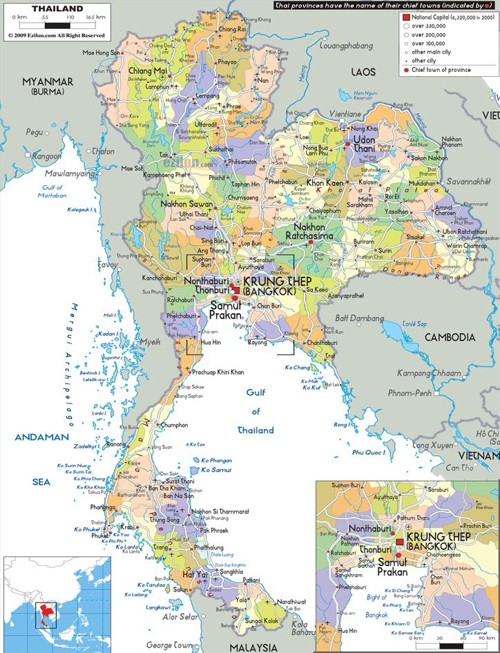
This is an
administrative map of Thailand showing the various states which includes major
highways and airports.
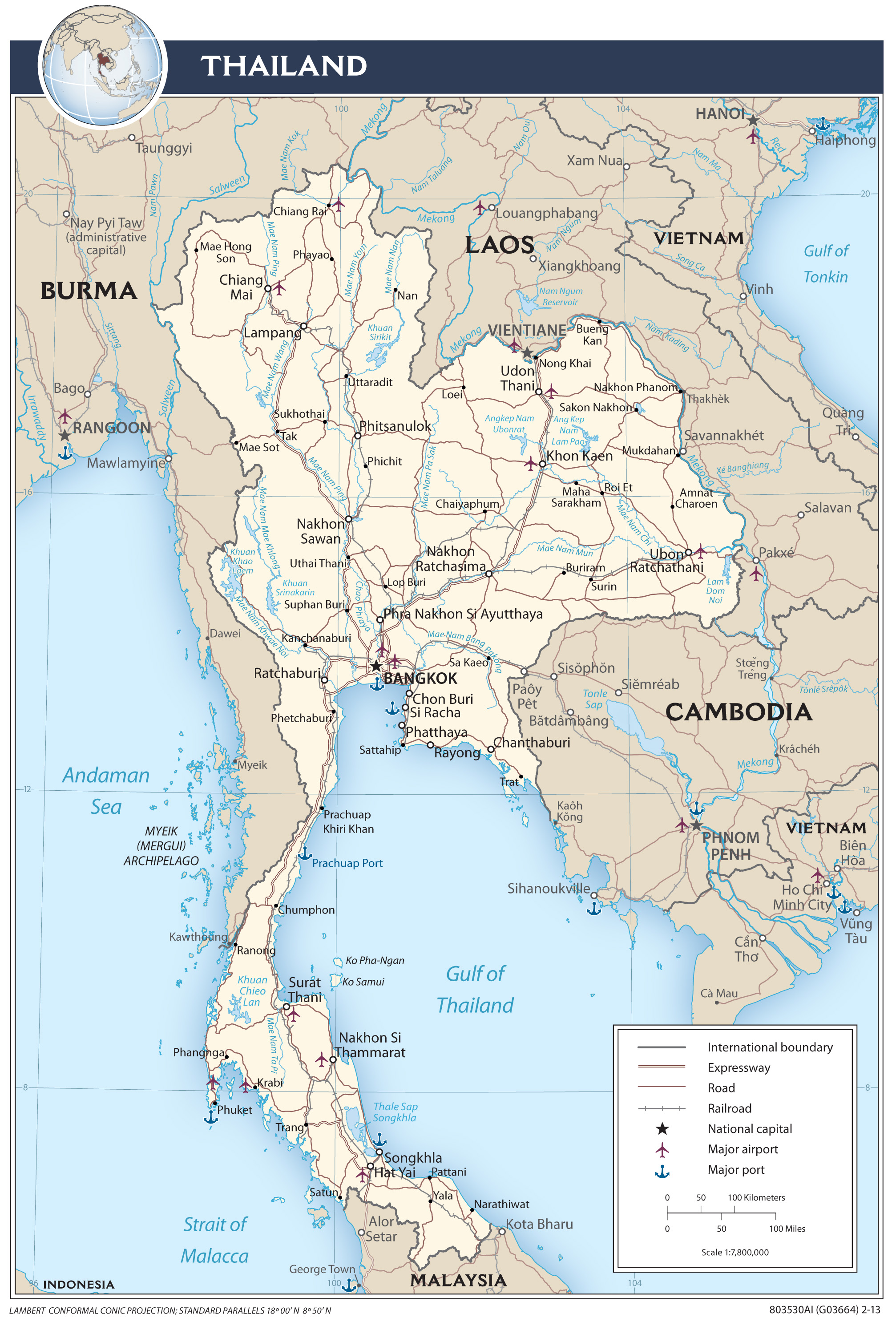
This is a
transportation map that shows expressways, roads, railways, ports, and
airports.
Roads and other
modes of transportation are depicted on this map including detailed
transportation in surrounding countries.
5 City Maps
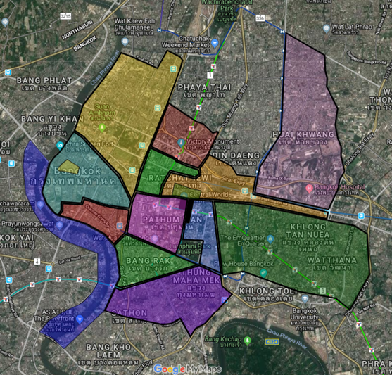
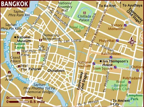
This is a city map showing the outline of the greater Bangkok metropolitan area including the multiple districts/towns that comprise the region.
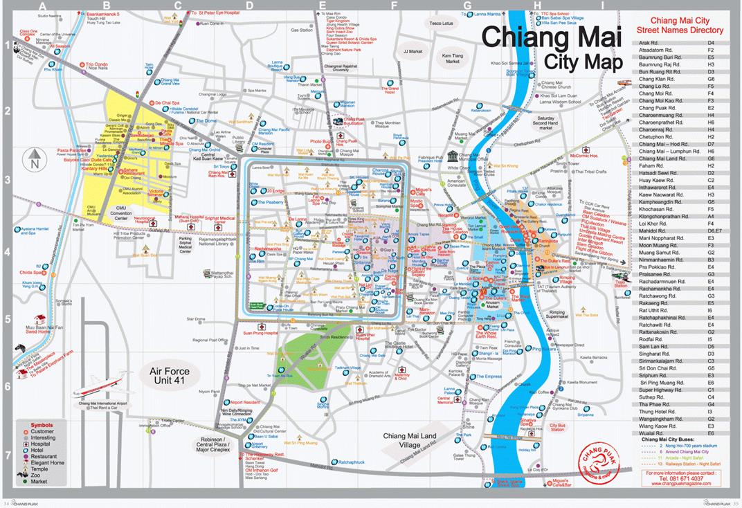
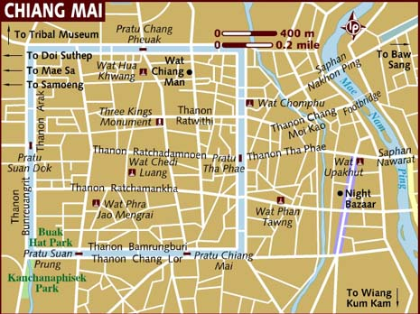
This is a city map of Chiang Mai, a city in northwestern Thailand.
This is a city map of Udon Thani, a city in the northeast of Thailand.

6 Urban
Transportation
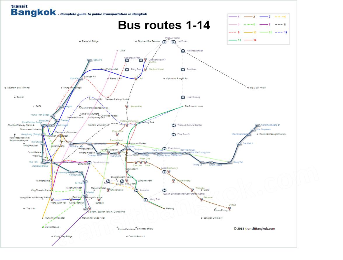
This is a map of the bus routes of Bangkok Buses 1-14.
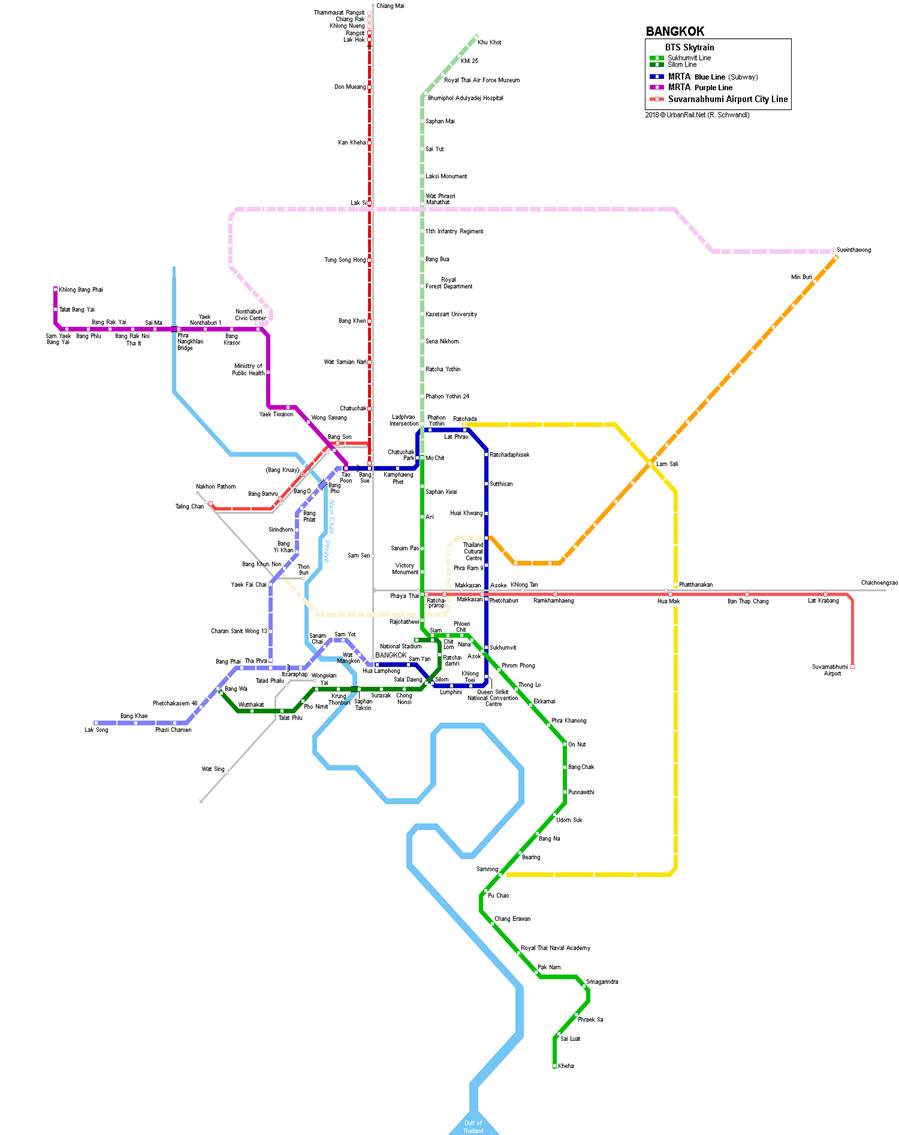
This is a map of the Bangkok Subway lines.
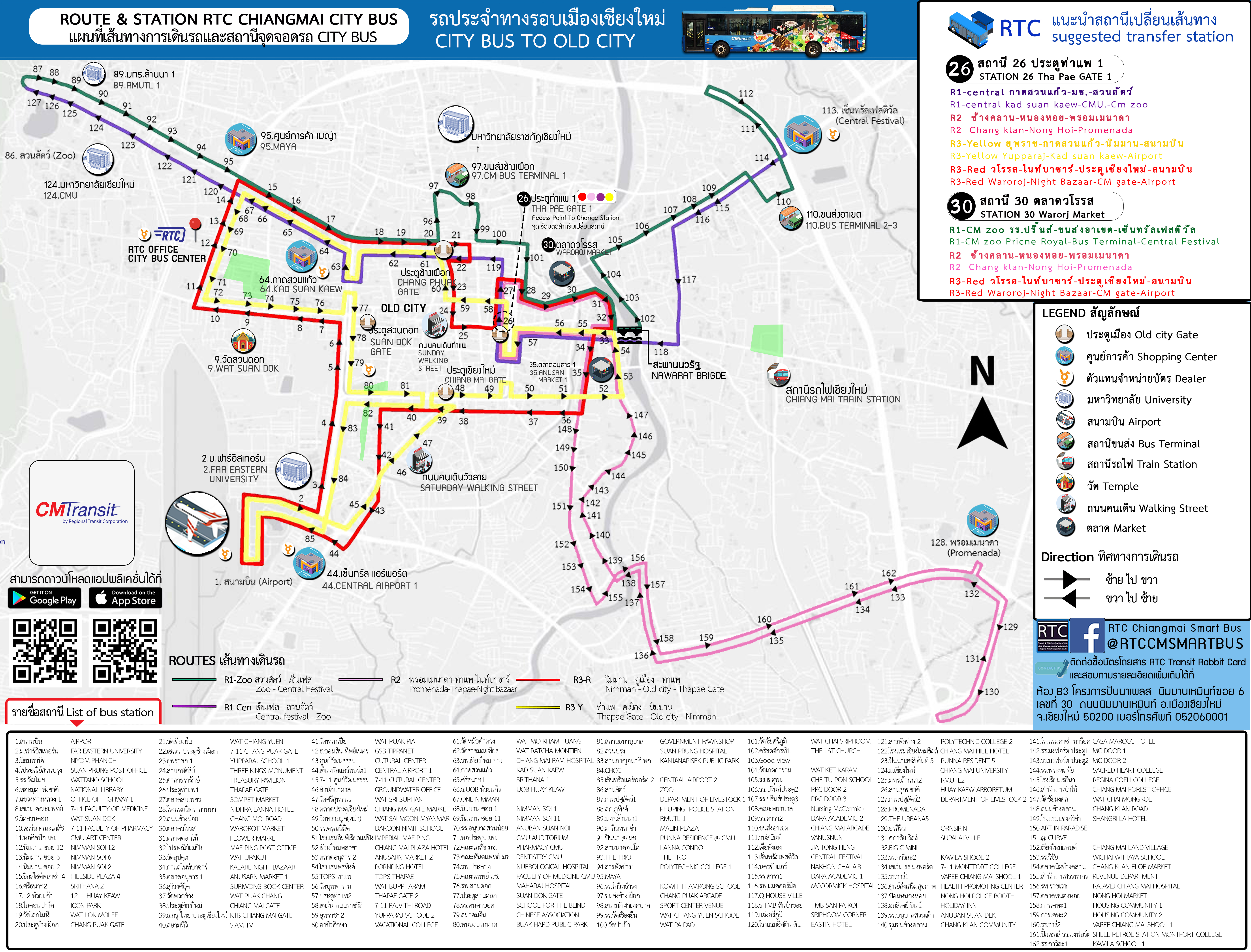
The Smart City Bus routes and stops through Chiang Mai are shown on this map.
7 Tourist Sites
This is a map showing various tourist sites in Chiang Mai’s inner city.
This is a map showing various tourist sites in and around the city center of Bangkok.
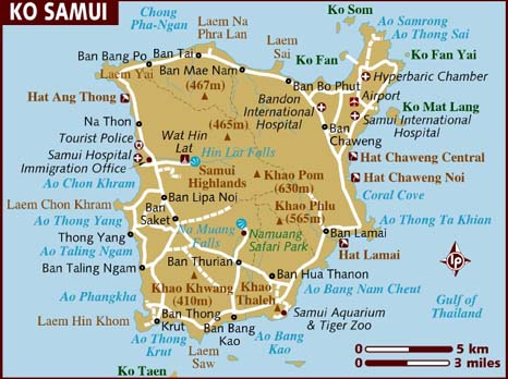
This map shows the various tourist sites on the island Ko Samui.
Updated
by Kate Lade on 3/7/2019.